Cross-Country Route Planning
It’s a topic people ask me about more than perhaps any other: if you’re planning a cross-country road trip, what route should you take?
It’s also a topic where you’ll find a lot of bad information out there. You’ll hear from people who have done only one route, whose opinion of the other choices is based on hearsay or speculation. People who have done it once or twice, possibly in a hurry, whose experience is skewed by conditions that don’t apply to your trip. Basically, it’s an area where there are more opinions than experience.
Nowadays, some folks will simply do whatever their GPS tells them to do, like mindless zombies. I’d rather enjoy the trip. GPS can’t tell you why you should go one way rather than the other.
So, I’m going to go over your choices. Obviously all of the possible trips are well beyond the scope of a single post, so I’m starting with the most common (in my experience) topic: driving from the Northeast to either Las Vegas or Los Angeles, or vice-versa.
I have driven everything I’m writing about here, multiple times, so this is first-hand reporting.
Southern Route
For the Southern Route, take the Pennsylvania Turnpike to I-70. I-70 takes you west to St Louis, where you pick up I-44 to Oklahoma City. There, get on I-40 west to Arizona. If you’re going to Las Vegas, you then take US-93 the rest of the way. Or, proceed on I-40 into California and then I-15 to Los Angeles.
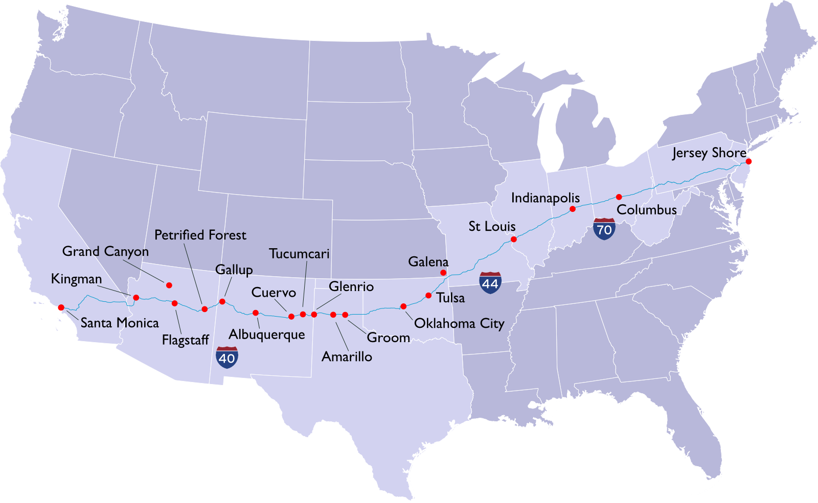
This is my favorite route. Although Ohio, Indiana, and Illinois aren’t very interesting, they go by pretty quickly. From St Louis on, though, you’re more or less following Historic Route 66—you could spend your life exploring all the wonderful stuff on this route.
Toward the end of Missouri, Route 66 briefly deviates from the Interstate route. You can take a leisurely side trip by following this route through Joplin into Galena, Kansas, and then down into Oklahoma where you rejoin the main route on I-44 (which is also the Oklahoma Turnpike).
Proceed through Tulsa to Oklahoma City, either of which offer a great stopover. In Oklahoma City pick up I-40.

There are so many Route 66 sites and other stops on this route that you’ll never get to them all. You’ll cross from the wonderful-smelling Oklahoma into the dry plains of Texas. In Groom you’ll see the “largest cross in the western hemisphere” on the side of the highway. Amarillo is your next oasis of civilization; if you’re looking for a place to stop or some good food, Amarillo is as good as it gets.
Then you get the beauty of the New Mexico desert. If you didn’t stop in Oklahoma or Amarillo, Tucumcari (pronounced like “two come carry”) is a Route 66 town, a traditional stop for explorers, offering dirt-cheap, clean, and nostalgic motels that will make you weep for the good old days.
You can explore the ghost towns of Glenrio, Texas, and Cuervo, New Mexico, if you’re into that sort of thing. Both are right off the Interstate, so no side trips are necessary.
The next oasis of civilization is Albuquerque. It’s the only opportunity you’ll have for anything like Starbucks or Applebee’s for some time, so you’ll probably want to stop here for a bit. After that, Gallup is another Route 66 town offering some amount of civilization.

After crossing into Arizona, you can take a quick car tour of Petrified Forest National Park, which you can do in a couple hours, and then it’s on to Flagstaff. On the way are many interesting Route 66 stops, including Two Guns, Twin Arrows, and Winslow, where you can stand on that corner from the Eagles song “Take It Easy.”
In Flagstaff, you can find civilization, frustrating traffic, overpriced hotels—and a side trip to the Grand Canyon. The South Rim is 80 miles from Flagstaff.
From Kingman, Arizona, if you’re headed to Las Vegas, you can head up US 93 to I-11 past the Hoover Dam. Or, stay on I-40 into California, through the Mohave Desert to I-15 and on to Los Angeles.
If you get the impression from how much I have to say that I love this drive, you’re right. When someone says to “imagine your favorite place,” I don’t think of a single place, I think of driving this route. If you’re planning your first cross-country road trip, this is the route you need to take.
The Confederate Variation
Another option is to go from the Pennsylvania Turnpike onto I-81 South, picking up I-40 in Tennessee. This is the same as the Southern Route, changed in the east to head through Virginia, Tennessee, and Arkansas, in what I call the “Confederate Variation.”
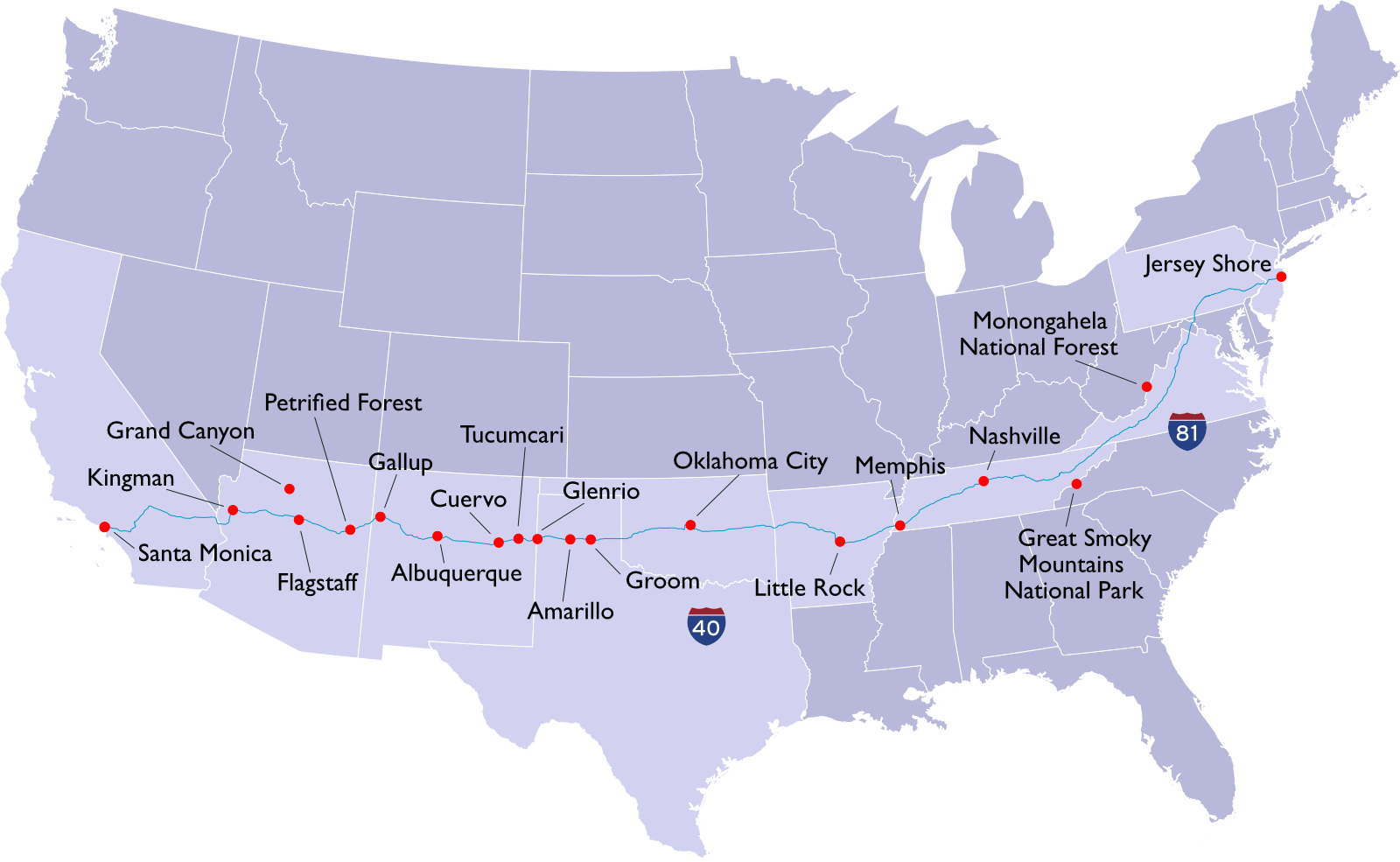
This route takes longer and is less interesting than the eastern part of I-70. It doesn’t make a lick of sense unless you want to stop someplace along the way.
Candidates include: Great Smoky Mountains National Park in Tennessee; nearby Gatlinburg, Tennessee; Nashville, if you’re into country music; and Little Rock, where you’ll find the Bill Clinton Presidential Library.
West Virginia’s Mongahela National Forest is a quick side-trip away from this route, if you want to go camping. (The campgrounds at Lake Sherwood have hot showers!)
You’ll rejoin the Southern Route in Oklahoma City.
Middle-America Route
For the Middle-America Route, you pick up I-70 in Pennsylvania and stay on it all the way to its end in Utah, where I-15 South will take you through Las Vegas to Los Angeles.
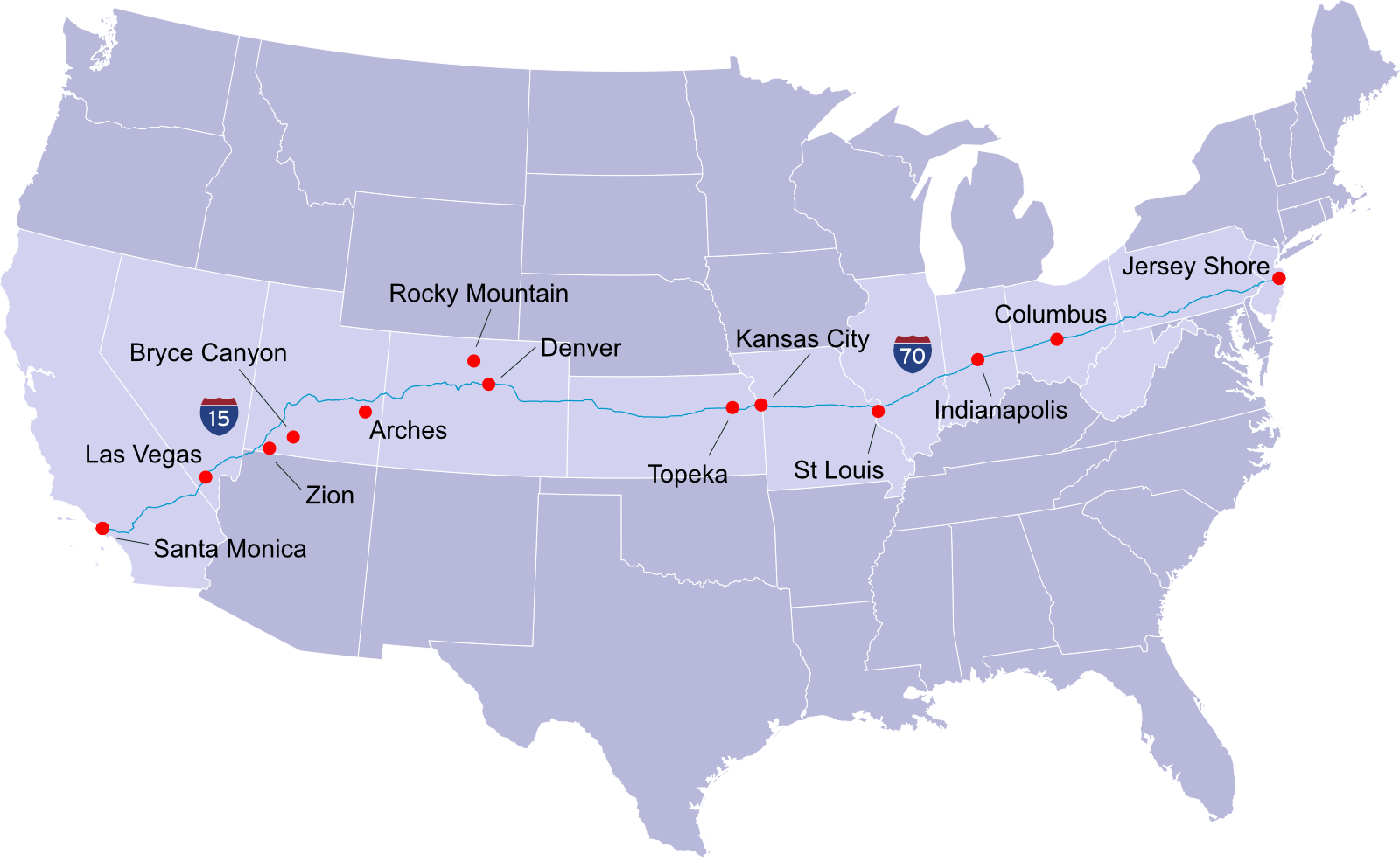
This is the fastest route. It’s not as great as the Southern Route, but sometimes you need variety, and instead of the desert, you get the prairies of the Midwest and the Rocky Mountains.
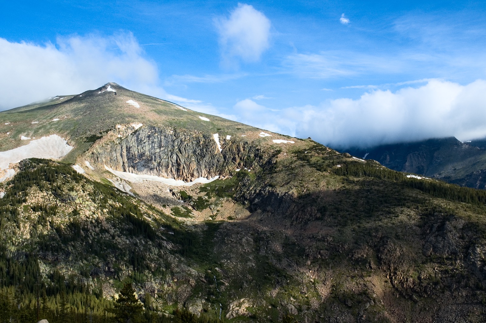
When you get to Denver, Rocky Mountain National Park is less than two hours away as a side trip. If you’ve never had the opportunity to drive your car above the clouds, take this side trip—but only in the summer.
The mountain pass west of Denver is a marvel of civil engineering, and reaches over ten thousand feet of elevation at Vail Pass: in the winter, this is not the best route to choose. If you use this route in winter, or even spring, check the local weather forecasts carefully before leaving Denver. You can still bail out: take I-25 south to Albuquerque and join the Southern Route. Tire chains are mandatory here in winter; if you don’t have them and know how to use them, this is not where you want to be in January.
Once you cross into Utah there are several side trips to consider. Arches National Park is an easy drive from the Interstate, and Canyonlands National Park isn’t far from there (but less interesting as a quick car tour). Bryce Canyon is two hours from the Interstate but well worth it. Zion National Park is off I-15 as you head toward Nevada. If choosing only one, go with Bryce Canyon.
In Utah, I-70 goes though a long stretch of nothing: no gas, food, lodging, towns, cows, or anything else at all. Make sure to fuel up beforehand; there are signs to warn you (a lot of people run out of gas here). In the middle of this desert wasteland, the 75mph speed limit inexplicably drops to 60. It’s not well-posted, and the highway patrol revenue agents may well be there to greet you. It’s the speed trap to end all speed traps, and the out-of-staters are the targets. I have a speeding ticket as a souvenir that I wouldn’t have gotten had I known the speed limit changed. Be careful here.
In the Utah desert, I-70 ends, and I-15 will take you to Las Vegas and on to Los Angeles. If you enjoy scenery, you will love it. There are places to stop, to rest or sleep or take pictures, but few services, so be prepared.
The Bad Route
If you ask Google Maps to take you from New York to Las Vegas with no further instructions, the first route it will give you is I-80 to I-76 to I-70 to I-15. I’m not going to waste the time to make a map of this route, because under no circumstances should you ever consider using it. The only reason I can imagine why Google brings it up first is because someone at Google hates you, and gets a kick out of imagining you choosing this route and having a miserable trip.
I-80 through Pennsylvania is fine, but from Ohio through Illinois, it’s a miserable journey of slow toll roads with nothing of interest on the way. The toll roads are turnpike-style, so casually getting off at an exit means paying the toll, then getting a new ticket on re-entry. You get to pass through Gary, Indiana, which has a great song, but is otherwise a _bleep_ing _bleep_hole the likes of which you have never before imagined. I’ve had road construction divert me onto scary-looking Chicago-area streets with no further instructions or “detour” signs telling me what to do next.
Eventually you get to Iowa, where things aren’t so bad, but by that point your spirit is broken. I’m not kidding: never go this way. Trust me. The relative pleasantness of Iowa and Nebraska doesn’t make up for what you just went through, and I-76 through the Colorado prairie is less interesting than it sounds. The I-80 Northern Route has its uses and its good parts (in the west), but this cross-country drive is not among them.